
Mauborget topographic map
Interactive map
Click on the map to display elevation.
About this map
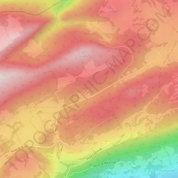
Name: Mauborget topographic map, elevation, terrain.
Location: Mauborget, District du Jura-Nord vaudois, Vaud, 1453, Suisse (46.84826 6.58726 46.88677 6.62814)
Average elevation: 1,218 m
Minimum elevation: 756 m
Maximum elevation: 1,450 m