
Madudu topographic map
Interactive map
Click on the map to display elevation.
About this map
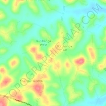
Name: Madudu topographic map, elevation, terrain.
Location: Madudu, Mubende, Central Region, Uganda (0.49932 31.55201 0.53932 31.59201)
Average elevation: 1,237 m
Minimum elevation: 1,204 m
Maximum elevation: 1,288 m
Other topographic maps
Click on a map to view its topography, its elevation and its terrain.