Geolocate

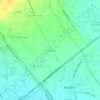
Santa Ines topographic map

Click on the map to display elevation.

About this map

Name: Santa Ines topographic map, elevation, terrain.

Location: Santa Ines, Bacolor, Pampanga, Central Luzon, 2001, Philippines (14.98894 120.64817 15.00359 120.66868)

Average elevation: 8 m

Minimum elevation: 3 m

Maximum elevation: 13 m

Other topographic maps

Click on a map to view its topography, its elevation and its terrain.

Talba

Philippines > Pampanga > Bacolor

Average elevation: 6 m

Parulog

Philippines > Pampanga > Bacolor

Average elevation: 12 m

San Antonio

Philippines > Pampanga > Bacolor

Average elevation: 18 m

Santa Ines

Philippines > Pampanga > Bacolor

Average elevation: 8 m

Potrero

Philippines > Pampanga > Bacolor

Average elevation: 38 m

Parulog

Philippines > Pampanga > Bacolor

Average elevation: 12 m

San Antonio

Philippines > Pampanga > Bacolor

Average elevation: 18 m

Santa Ines

Philippines > Pampanga > Bacolor

Average elevation: 8 m

Parulog

Philippines > Pampanga > Bacolor

Average elevation: 12 m

Gear up for your next adventure:

🧭Global Orienteering Compass - High-precision liquid-filled compasses for accurate map reading and navigation
📦Crushproof Equipment Cases - Safe transport for sensitive surveying and mapping instruments
🧤Hiking Gloves - Protective gloves for outdoor use
🛌Sleeping Mats - Insulated mats for camping comfort
📟Satellite Messengers - Two-way satellite communication to stay in touch beyond the cellular grid

As an Amazon Associate, this site earns from qualifying purchases at no extra cost to you.