Geolocate

Fleet topographic map

Click on the map to display elevation.

About this map
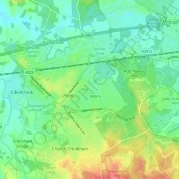
Name: Fleet topographic map, elevation, terrain.

Location: Fleet, Hart, Hampshire, England, United Kingdom (51.26322 -0.87594 51.30238 -0.79030)

Average elevation: 76 m

Minimum elevation: 56 m

Maximum elevation: 118 m

Other topographic maps

Click on a map to view its topography, its elevation and its terrain.

Brookly Stream

United Kingdom > England > Hampshire > Hart > Fleet

Average elevation: 78 m

Gear up for your next adventure:

🪢Paracord - Multi-purpose survival cord
📕Australia Maps - Maps covering Australian regions
📚Map Reading & Navigation Guides - Master the art of interpreting topographic contours and symbols
🔥Windproof Plasma Lighters - USB rechargeable lighters that work in high-altitude winds
🧢Outdoor Sun Hats - Sun protection hats for hiking

As an Amazon Associate, this site earns from qualifying purchases at no extra cost to you.