Geolocate

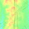
Bellmead topographic map

Click on the map to display elevation.

About this map
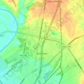
Name: Bellmead topographic map, elevation, terrain.

Location: Bellmead, McLennan County, Texas, 76705, United States (31.57291 -97.12324 31.63103 -97.06051)

Average elevation: 135 m

Minimum elevation: 119 m

Maximum elevation: 153 m

Other topographic maps

Click on a map to view its topography, its elevation and its terrain.

Cameron Park

United States > Texas > McLennan County > Waco

Average elevation: 137 m

Elm Mott

United States > Texas > McLennan County

Average elevation: 156 m

South Bosque

United States > Texas > McLennan County > Waco

Average elevation: 161 m

Waco

United States > Texas > McLennan County > Waco

Average elevation: 150 m

Hewitt

United States > Texas > McLennan County > Hewitt > Hewitt

Average elevation: 189 m

Bruceville-Eddy

United States > Texas > McLennan County

Average elevation: 198 m

Gear up for your next adventure:

🌬️Windbreaker Jackets - Wind protection jackets
🧤Thermal Hiking Gloves - Keep your hands warm and functional during high-altitude winter treks
🥾Hiking Shoes - Lightweight hiking shoes for day hikes
🔋Solar Power Banks - Charge your phone and GPS using the sun while deep in the bush
🎨Portable Watercolor Kits - Paint the landscapes and topographic views you discover

As an Amazon Associate, this site earns from qualifying purchases at no extra cost to you.