
Île du Canard-Blanc topographic map
Interactive map
Click on the map to display elevation.
About this map
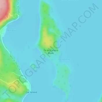
Name: Île du Canard-Blanc topographic map, elevation, terrain.
Average elevation: 208 m
Minimum elevation: 191 m
Maximum elevation: 348 m
Other topographic maps
Click on a map to view its topography, its elevation and its terrain.
Baie-de-l'Ours
Canada > Québec > Papineau > Lac-Simon > Baie-de-l'Ours
Baie-de-l'Ours, Lac-Simon, Papineau, Outaouais, Québec, Canada
Average elevation: 217 m