Geolocate

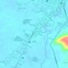
Balite topographic map

Click on the map to display elevation.

About this map

Name: Balite topographic map, elevation, terrain.

Location: Balite, Calapan, Oriental Mindoro, Mimaropa, Philippines (13.39660 121.14010 13.43660 121.18010)

Average elevation: 2 m

Minimum elevation: 0 m

Maximum elevation: 52 m

Other topographic maps

Click on a map to view its topography, its elevation and its terrain.
Masipit

Philippines > Oriental Mindoro > Calapan

Average elevation: 4 m

Lalud

Philippines > Oriental Mindoro > Calapan

Average elevation: 8 m

Tibag

Philippines > Oriental Mindoro > Calapan

Average elevation: 5 m

Santo Niño

Philippines > Oriental Mindoro > Calapan

Average elevation: 19 m

Camilmil

Philippines > Oriental Mindoro > Calapan

Average elevation: 12 m

Gear up for your next adventure:

🦟Heavy Duty Insect Repellent - Essential protection against flies, mozzies, and march flies
🥾Hiking Boots - Durable hiking boots for trails and rough terrain
🎒3L Hydration Reservoirs - Hands-free drinking to stay hydrated on steep contour climbs
🧤Thermal Hiking Gloves - Keep your hands warm and functional during high-altitude winter treks
🖼️Scratch-off Australia Map - Track the regions and peaks you have explored geographically

As an Amazon Associate, this site earns from qualifying purchases at no extra cost to you.