
Saint-Germain topographic map
Interactive map
Click on the map to display elevation.
About this map
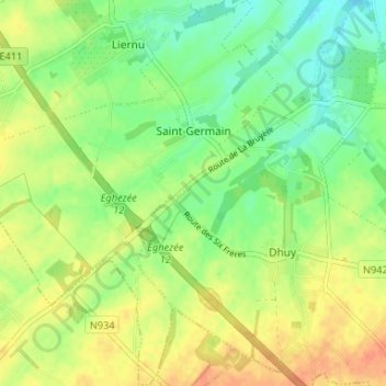
Name: Saint-Germain topographic map, elevation, terrain.
Location: Saint-Germain, Éghezée, Namur, Wallonia, 5310, Belgium (50.54526 4.80233 50.58694 4.85666)
Average elevation: 163 m
Minimum elevation: 144 m
Maximum elevation: 184 m
Other topographic maps
Click on a map to view its topography, its elevation and its terrain.