Geolocate

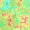
Menglun topographic map

Click on the map to display elevation.

About this map

Name: Menglun topographic map, elevation, terrain.

Location: Menglun, Mengla County, Xishuangbanna, Yunnan, 666300, China (21.89766 101.20753 21.97766 101.28753)

Average elevation: 669 m

Minimum elevation: 529 m

Maximum elevation: 1,195 m

Other topographic maps

Click on a map to view its topography, its elevation and its terrain.
Mohan

China > Yunnan > Mengla County

Average elevation: 962 m

Gear up for your next adventure:

🦯Trekking Poles - Walking poles for hiking stability
🧣Merino Neck Gaiters - Versatile headwear for warmth, sun protection, or dust filtering
🎽Hiking Clothing - Breathable clothing for hiking
🧭Compass - Navigation compasses for outdoor exploration
🥾Trail Running Shoes - Shoes for trail running

As an Amazon Associate, this site earns from qualifying purchases at no extra cost to you.