
Yoakam Point topographic map
Interactive map
Click on the map to display elevation.
About this map
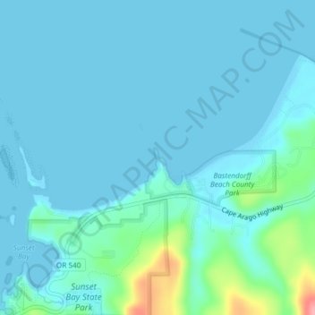
Name: Yoakam Point topographic map, elevation, terrain.
Location: Yoakam Point, Charleston, Coos County, Oregon, USA (43.33319 -124.37074 43.35319 -124.35074)
Average elevation: 13 m
Minimum elevation: -2 m
Maximum elevation: 107 m