
石翁村 topographic map
Interactive map
Click on the map to display elevation.
About this map
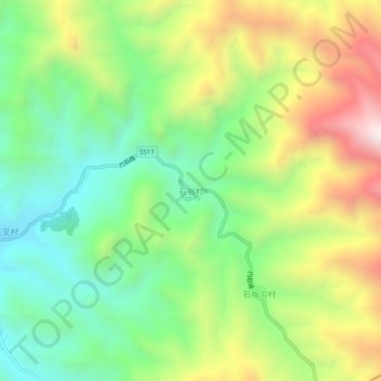
Name: 石翁村 topographic map, elevation, terrain.
Location: 石翁村, 门限石乡, 五台县, 忻州市, 山西省, 中国 (38.74071 113.73208 38.78071 113.77208)
Average elevation: 1,600 m
Minimum elevation: 1,251 m
Maximum elevation: 2,136 m
Other topographic maps
Click on a map to view its topography, its elevation and its terrain.