Geolocate

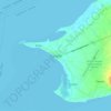
Looc topographic map

Click on the map to display elevation.

About this map

Name: Looc topographic map, elevation, terrain.

Location: Looc, Panglao, Bohol, Central Visayas, 6340, Philippines (9.58179 123.74038 9.59600 123.76799)

Average elevation: 6 m

Minimum elevation: 0 m

Maximum elevation: 12 m

Other topographic maps

Click on a map to view its topography, its elevation and its terrain.
Panglao

Philippines > Bohol > Panglao

Average elevation: 4 m

Daorong

Philippines > Bohol > Panglao > Danao

Average elevation: 3 m

Canghilbas

Philippines > Bohol > Panglao > Lourdes

Average elevation: 22 m

Gear up for your next adventure:

🧴SPF 50+ Bulk Sunscreen - Maximum protection for long-term outdoor exposure
📦Crushproof Equipment Cases - Safe transport for sensitive surveying and mapping instruments
🧦Hiking Socks - Comfortable socks for long hikes
🖼️Scratch-off Australia Map - Track the regions and peaks you have explored geographically
🕯️Emergency Whistles - Safety whistles for hiking

As an Amazon Associate, this site earns from qualifying purchases at no extra cost to you.