Geolocate

Peninsula topographic map

Click on the map to display elevation.

About this map

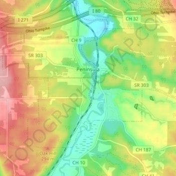
Name: Peninsula topographic map, elevation, terrain.

Location: Peninsula, Summit County, Ohio, United States (41.21916 -81.58454 41.25266 -81.51891)

Average elevation: 259 m

Minimum elevation: 198 m

Maximum elevation: 329 m

Gear up for your next adventure:

🔌Fast Charging Adapters - Quickly top up all your gear before heading back into the field
📱Shockproof Phone Cases - Extra protection for your smartphone against drops on rocky terrain
🔥Ferrocerium Rod Fire Starters - Reliable fire lighting in wet or windy conditions without matches
📖Australian Bush Survival Books - Local knowledge on finding water and surviving the outback
🛌Sleeping Bags - Sleeping bags for outdoor camping

As an Amazon Associate, this site earns from qualifying purchases at no extra cost to you.