
Republic topographic map
Click on the map to display elevation.
About this map
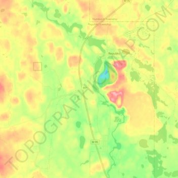
Name: Republic topographic map, elevation, terrain.
Location: Republic, Marquette County, Michigan, United States (46.35104 -87.99846 46.43039 -87.96134)
Average elevation: 467 m
Minimum elevation: 407 m
Maximum elevation: 523 m
Other topographic maps
Click on a map to view its topography, its elevation and its terrain.
Van Riper State Park
United States > Michigan > Marquette County > Michigamme Township
Average elevation: 489 m
Skinnies Lake
United States > Michigan > Marquette County > Humboldt Township
Average elevation: 453 m
Horseshoe Lake
United States > Michigan > Marquette County > Republic Township
Average elevation: 503 m