

Aalborg topographic map
Click on the map to display elevation.
Aalborg
The area close to the waterfront is low-lying, with an elevation averaging about 5 metres (16 ft), but there are many hills in and around city, some reaching over 60 m (200 ft). Nørresundby, on the northern side of the sound, is also a hilly area. Villages to the south of Aalborg from west to east include Frejlev, Svenstrup, and Gistrup (which contains extensive woodland to the south as well as a golf club). Klarup and Storvorde lie to the southeast along the 595 road, which, flanking a stretch of the Limfjord known as Langerak, leads to the town of Hals. Nibe, with a harbour on the Limfjord, is 21 kilometres (13 mi) to the southwest, past the village of Frejlev. The Nibe Broads (Nibe Bredning) in the Limfjord not only has the largest eelgrass belts in Danish waters but is an important sanctuary for thousands of migratory birds. To the north of the city, villages include Vadum, Aabybro, Vestbjerg, Sulsted, Tylstrup, Vodskov, and Hjallerup. There is an extensive plantation, Branths Plantage - Møgelbjerg, immediately north of Vodskov.
About this map
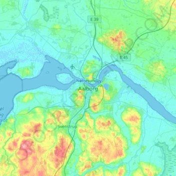
Name: Aalborg topographic map, elevation, terrain.
Average elevation: 17 m
Minimum elevation: -3 m
Maximum elevation: 104 m
Other topographic maps
Click on a map to view its topography, its elevation and its terrain.




