Geolocate

Angeles topographic map

Click on the map to display elevation.

About this map

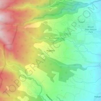
Name: Angeles topographic map, elevation, terrain.

Location: Angeles, Davao City, Davao Region, Philippines (7.00057 125.36532 7.04057 125.40532)

Average elevation: 984 m

Minimum elevation: 668 m

Maximum elevation: 1,452 m

Gear up for your next adventure:

🧥Thermal Emergency Blankets - Compact Mylar blankets to prevent hypothermia if stranded overnight
👣Snake & Scrub Gaiters - Protection against spinifex, mud, and snakes while walking off-track
📡Weather Radios - Emergency weather radios
🪫Rechargeable Headlamps - USB rechargeable headlamps
📣High-Decibel Survival Whistles - Signaling tool for rescue that carries much further than a human voice

As an Amazon Associate, this site earns from qualifying purchases at no extra cost to you.