
Thank you for supporting this site ❤️
Make a donation
Make a donation
Gear up for your next adventure:
As an Amazon Associate, this site earns from qualifying purchases at no extra cost to you.
Jhagadia topographic map
Click on the map to display elevation.
Thank you for supporting this site ❤️
Make a donation
Make a donation
Gear up for your next adventure:
As an Amazon Associate, this site earns from qualifying purchases at no extra cost to you.
About this map
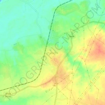
Name: Jhagadia topographic map, elevation, terrain.
Location: Jhagadia, Jhagadiya Taluka, Bharuch, Gujarat, 393110, India (21.69572 73.12970 21.73572 73.16970)
Average elevation: 26 m
Minimum elevation: 3 m
Maximum elevation: 50 m
Thank you for supporting this site ❤️
Make a donation
Make a donation
Gear up for your next adventure:
As an Amazon Associate, this site earns from qualifying purchases at no extra cost to you.