
Thank you for supporting this site ❤️
Make a donation
Make a donation
Gear up for your next adventure:
As an Amazon Associate, this site earns from qualifying purchases at no extra cost to you.
Ambang topographic map
Click on the map to display elevation.
Thank you for supporting this site ❤️
Make a donation
Make a donation
Gear up for your next adventure:
As an Amazon Associate, this site earns from qualifying purchases at no extra cost to you.
About this map
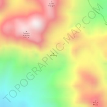
Name: Ambang topographic map, elevation, terrain.
Location: Ambang, Bolaang Mongondow Timur, North Sulawesi, Indonesia (0.74995 124.41995 0.75005 124.42005)
Average elevation: 1,379 m
Minimum elevation: 925 m
Maximum elevation: 1,760 m
Thank you for supporting this site ❤️
Make a donation
Make a donation
Gear up for your next adventure:
As an Amazon Associate, this site earns from qualifying purchases at no extra cost to you.