Geolocate

Earltown topographic map

Click on the map to display elevation.

About this map
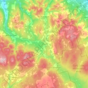
Name: Earltown topographic map, elevation, terrain.

Location: Earltown, Municipality of Colchester, Colchester County, Nova Scotia, Canada (45.51437 -63.19526 45.64082 -63.05870)

Average elevation: 202 m

Minimum elevation: 43 m

Maximum elevation: 359 m

Other topographic maps

Click on a map to view its topography, its elevation and its terrain.

Gear up for your next adventure:

🧥Thermal Emergency Blankets - Compact Mylar blankets to prevent hypothermia if stranded overnight
🍶Collapsible Water Bottles - Save space in your pack as you consume your water supply
📟Satellite Messengers - Two-way satellite communication to stay in touch beyond the cellular grid
🥶Thermal Beanies - Warm hats for cold hikes
🦘Outback Survival Gear - Essential gear for Australian outback

As an Amazon Associate, this site earns from qualifying purchases at no extra cost to you.