
Thank you for supporting this site ❤️
Make a donation
Make a donation
Gear up for your next adventure:
As an Amazon Associate, this site earns from qualifying purchases at no extra cost to you.
Kebanga topographic map
Click on the map to display elevation.
Thank you for supporting this site ❤️
Make a donation
Make a donation
Gear up for your next adventure:
As an Amazon Associate, this site earns from qualifying purchases at no extra cost to you.
About this map
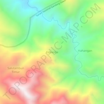
Name: Kebanga topographic map, elevation, terrain.
Location: Kebanga, Mamasa, West Sulawesi, Sulawesi, Indonesia (-2.82834 119.24688 -2.78834 119.28688)
Average elevation: 1,457 m
Minimum elevation: 923 m
Maximum elevation: 2,160 m
Thank you for supporting this site ❤️
Make a donation
Make a donation
Gear up for your next adventure:
As an Amazon Associate, this site earns from qualifying purchases at no extra cost to you.