
Daphne topographic map
Interactive map
Click on the map to display elevation.
Daphne
The topography of Daphne is quite consistent from a gently sloping sea level on the west to low rolling hills further east. Generally, the entire city lies no more than 150 feet above sea level. The land along the Daphne bay coast, like other land throughout the county, is rich with sandy-loam type soils.
About this map
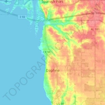
Name: Daphne topographic map, elevation, terrain.
Location: Daphne, Baldwin County, Alabama, United States (30.56903 -87.92237 30.67677 -87.84305)
Average elevation: 25 m
Minimum elevation: -2 m
Maximum elevation: 65 m