
航城街道 topographic map
Interactive map
Click on the map to display elevation.
About this map
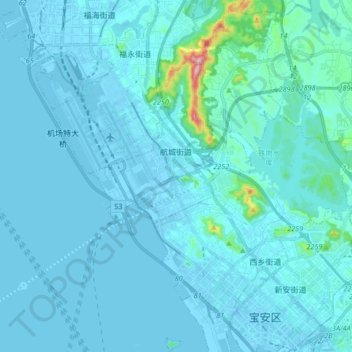
Name: 航城街道 topographic map, elevation, terrain.
Location: 航城街道, 宝安区, 深圳市, 广东省, 518100, 中国 (22.54436 113.79878 22.69730 113.88629)
Average elevation: 21 m
Minimum elevation: -14 m
Maximum elevation: 351 m
Other topographic maps
Click on a map to view its topography, its elevation and its terrain.