Geolocate

Seascale topographic map

Click on the map to display elevation.

About this map

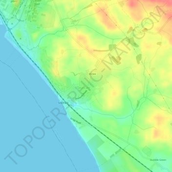
Name: Seascale topographic map, elevation, terrain.

Location: Seascale, Cumbria, England, United Kingdom (54.38155 -3.50394 54.41644 -3.45546)

Average elevation: 21 m

Minimum elevation: 0 m

Maximum elevation: 59 m

Gear up for your next adventure:

🔦Powerful LED Headlamps - Hands-free lighting for night navigation and setting up camp after dark
☀️Portable Solar Chargers - High-efficiency panels to hang on your backpack while walking
🧭Military Style Lensatic Compass - Durable sighting compasses for advanced land navigation and surveying
💧Personal Water Filters - Drink safely from streams and lakes identified on your map
🧢Outdoor Sun Hats - Sun protection hats for hiking

As an Amazon Associate, this site earns from qualifying purchases at no extra cost to you.