
Igriés topographic map
Interactive map
Click on the map to display elevation.
About this map
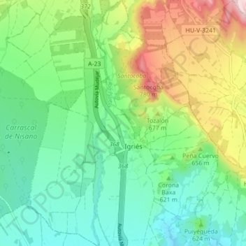
Name: Igriés topographic map, elevation, terrain.
Location: Igriés, Hoya de Huesca, Huesca, Aragón, España (42.19309 -0.46195 42.24444 -0.40859)
Average elevation: 624 m
Minimum elevation: 530 m
Maximum elevation: 822 m