Geolocate

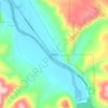
Ammon topographic map

Click on the map to display elevation.

About this map

Name: Ammon topographic map, elevation, terrain.

Location: Ammon, Bonneville County, Idaho, 83406, United States (43.43882 -111.98452 43.51136 -111.89777)

Average elevation: 1,445 m

Minimum elevation: 1,422 m

Maximum elevation: 1,594 m

Other topographic maps

Click on a map to view its topography, its elevation and its terrain.

Ririe Dam

United States > Idaho > Bonneville County

Average elevation: 1,585 m

Palisades

United States > Idaho > Bonneville County

Average elevation: 1,762 m

Black Mountain

United States > Idaho > Bonneville County

Average elevation: 2,471 m

Ririe Reservoir

United States > Idaho > Bonneville County

Average elevation: 1,720 m

Mount Baldy

United States > Idaho > Bonneville County

Average elevation: 2,089 m

Wheaton Mountain

United States > Idaho > Bonneville County

Average elevation: 1,855 m

Gear up for your next adventure:

🍶Collapsible Water Bottles - Save space in your pack as you consume your water supply
👟Lightweight Trail Runners - Agile footwear for fast movement over rugged Australian terrain
🪑Portable Backpacking Chairs - A comfortable seat for studying maps at the end of the day
🥾Heavy Duty Hiking Boots - Ankle-supporting boots for carrying heavy packs on steep contours
🧤Thermal Hiking Gloves - Keep your hands warm and functional during high-altitude winter treks

As an Amazon Associate, this site earns from qualifying purchases at no extra cost to you.