
Baie des Chaleurs topographic map
Interactive map
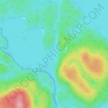
Click on the map to display elevation.
About this map
Name: Baie des Chaleurs topographic map, elevation, terrain.
Average elevation: 280 m
Minimum elevation: 235 m
Maximum elevation: 404 m
Other topographic maps
Click on a map to view its topography, its elevation and its terrain.
Lac Lanthier
Canada > Québec > Antoine-Labelle > Lac-Douaire
Lac Lanthier, Lac-Douaire, Antoine-Labelle, Laurentides, Québec, Canada
Average elevation: 448 m
Lac Faucon
Canada > Québec > Antoine-Labelle > Lac-Douaire
Lac Faucon, Lac-Douaire, Antoine-Labelle, Laurentides, Québec, Canada
Average elevation: 471 m