
Thank you for supporting this site ❤️
Make a donation
Make a donation
Gear up for your next adventure:
As an Amazon Associate, this site earns from qualifying purchases at no extra cost to you.
Olten topographic map
Click on the map to display elevation.
Thank you for supporting this site ❤️
Make a donation
Make a donation
Gear up for your next adventure:
As an Amazon Associate, this site earns from qualifying purchases at no extra cost to you.
About this map
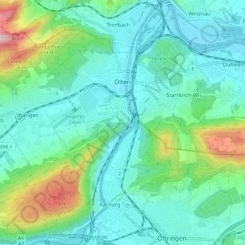
Name: Olten topographic map, elevation, terrain.
Location: Olten, Bezirk Olten, Amtei Olten-Gösgen, Solothurn, Switzerland (47.31103 7.87485 47.36892 7.92908)
Average elevation: 475 m
Minimum elevation: 381 m
Maximum elevation: 816 m
Thank you for supporting this site ❤️
Make a donation
Make a donation
Gear up for your next adventure:
As an Amazon Associate, this site earns from qualifying purchases at no extra cost to you.