
Thank you for supporting this site ❤️
Make a donation
Make a donation
Gear up for your next adventure:
As an Amazon Associate, this site earns from qualifying purchases at no extra cost to you.
Sarrocu/Sarroch topographic map
Click on the map to display elevation.
Thank you for supporting this site ❤️
Make a donation
Make a donation
Gear up for your next adventure:
As an Amazon Associate, this site earns from qualifying purchases at no extra cost to you.
About this map
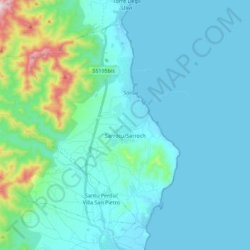
Name: Sarrocu/Sarroch topographic map, elevation, terrain.
Location: Sarrocu/Sarroch, Casteddu/Cagliari, Sardinia, 09018, Italy (39.02012 8.88568 39.12118 9.04586)
Average elevation: 90 m
Minimum elevation: -3 m
Maximum elevation: 707 m
Thank you for supporting this site ❤️
Make a donation
Make a donation
Gear up for your next adventure:
As an Amazon Associate, this site earns from qualifying purchases at no extra cost to you.