
Emfuleni Local Municipality topographic map
Interactive map
Click on the map to display elevation.
About this map
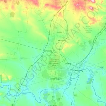
Name: Emfuleni Local Municipality topographic map, elevation, terrain.
Average elevation: 1,501 m
Minimum elevation: 1,409 m
Maximum elevation: 1,823 m
Other topographic maps
Click on a map to view its topography, its elevation and its terrain.
Lesedi Local Municipality
South Africa > Gauteng > Sedibeng District Municipality
Lesedi Local Municipality, Sedibeng District Municipality, Gauteng, 1441, South Africa
Average elevation: 1,613 m