
Thank you for supporting this site ❤️
Make a donation
Make a donation
Gear up for your next adventure:
As an Amazon Associate, this site earns from qualifying purchases at no extra cost to you.
Lerz topographic map
Click on the map to display elevation.
Thank you for supporting this site ❤️
Make a donation
Make a donation
Gear up for your next adventure:
As an Amazon Associate, this site earns from qualifying purchases at no extra cost to you.
About this map
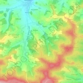
Name: Lerz topographic map, elevation, terrain.
Location: Lerz, Waldzell, Bezirk Ried im Innkreis, 4924, Austria (48.08513 13.40502 48.12513 13.44502)
Average elevation: 612 m
Minimum elevation: 525 m
Maximum elevation: 719 m
Thank you for supporting this site ❤️
Make a donation
Make a donation
Gear up for your next adventure:
As an Amazon Associate, this site earns from qualifying purchases at no extra cost to you.