
Zelenodol'sk topographic map
Interactive map
Click on the map to display elevation.
About this map
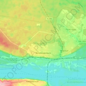
Name: Zelenodol'sk topographic map, elevation, terrain.
Average elevation: 90 m
Minimum elevation: 41 m
Maximum elevation: 183 m
Other topographic maps
Click on a map to view its topography, its elevation and its terrain.
Раифское сельское поселение
Russia > Tatarstan > Zelenodolsky District
Раифское сельское поселение, Zelenodolsky District, Tatarstan, Volga Federal District, Russia
Average elevation: 100 m