
Jamui topographic map
Interactive map
Click on the map to display elevation.
About this map
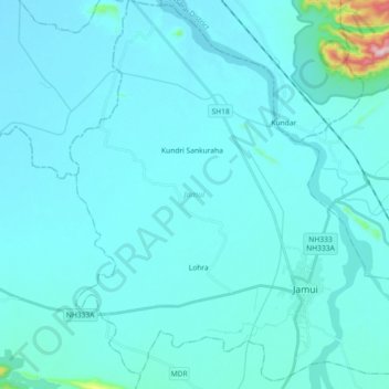
Name: Jamui topographic map, elevation, terrain.
Location: Jamui, Jamui District, Bihar, 811307, Indien (24.88511 86.11535 25.04976 86.29186)
Average elevation: 82 m
Minimum elevation: 54 m
Maximum elevation: 492 m
Other topographic maps
Click on a map to view its topography, its elevation and its terrain.
Gaya
Indien > Bihar > Gaya Town C.D.Block
Gaya, Gaya Town C.D.Block, Gaya District, Bihar, 823001, Indien
Average elevation: 111 m
Patna
Indien > Bihar > Patna Rural
Patna, Patna Rural, Distrikt Patna, Bihar, 800001, Indien
Average elevation: 51 m
Gehlour Ghati
Indien > Bihar > Gehlour Ghati
Gehlour Ghati, Muhra, Gaya, Bihar, Indien
Average elevation: 111 m