
后村河 topographic map
Interactive map
Click on the map to display elevation.
About this map
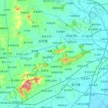
Name: 后村河 topographic map, elevation, terrain.
Location: 后村河, 东邵疃村, 日照市, 山东省, 276800, 中国 (35.34822 119.23158 35.39121 119.39078)
Average elevation: 54 m
Minimum elevation: 1 m
Maximum elevation: 358 m