
Hoogstede topographic map
Interactive map
Click on the map to display elevation.
About this map
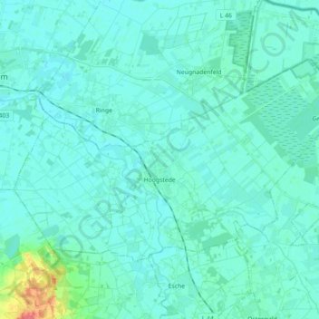
Name: Hoogstede topographic map, elevation, terrain.
Average elevation: 18 m
Minimum elevation: 11 m
Maximum elevation: 66 m
Other topographic maps
Click on a map to view its topography, its elevation and its terrain.
Bad Bentheim
Deutschland > Niedersachsen > Landkreis Grafschaft Bentheim
Bad Bentheim, Landkreis Grafschaft Bentheim, Niedersachsen, 48455, Deutschland
Average elevation: 38 m