
Kennedy topographic map
Interactive map
Click on the map to display elevation.
About this map
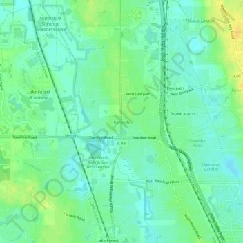
Name: Kennedy topographic map, elevation, terrain.
Average elevation: 207 m
Minimum elevation: 198 m
Maximum elevation: 222 m
Other topographic maps
Click on a map to view its topography, its elevation and its terrain.
Deerpath
United States > Illinois > Lake County > Lake Forest
Deerpath, Lake Forest, Lake County, Illinois, 60045, United States
Average elevation: 209 m
South Park
United States > Illinois > Lake County > Lake Forest
South Park, Lake Forest, Lake County, Illinois, United States
Average elevation: 208 m
Skokie Manor
United States > Illinois > Lake County > Lake Forest > Skokie Manor
Skokie Manor, Lake Forest, Lake County, Illinois, 60045, United States
Average elevation: 208 m
Everett
United States > Illinois > Lake County > Lake Forest > Everett
Everett, Lake Forest, Lake County, Illinois, 60045, United States
Average elevation: 207 m