
Thank you for supporting this site ❤️
Make a donation
Make a donation
Gear up for your next adventure:
As an Amazon Associate, this site earns from qualifying purchases at no extra cost to you.
Etla topographic map
Click on the map to display elevation.
Thank you for supporting this site ❤️
Make a donation
Make a donation
Gear up for your next adventure:
As an Amazon Associate, this site earns from qualifying purchases at no extra cost to you.
About this map
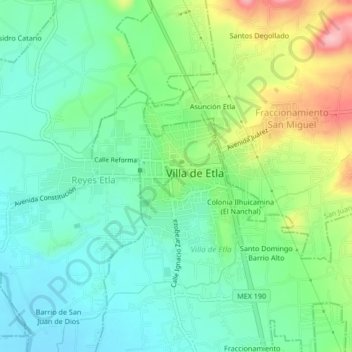
Name: Etla topographic map, elevation, terrain.
Location: Etla, Villa de Etla, Oaxaca, 68200, México (17.18536 -96.82041 17.22536 -96.78041)
Average elevation: 1,650 m
Minimum elevation: 1,602 m
Maximum elevation: 1,757 m
Thank you for supporting this site ❤️
Make a donation
Make a donation
Gear up for your next adventure:
As an Amazon Associate, this site earns from qualifying purchases at no extra cost to you.