
Make a donation
Gear up for your next adventure:
As an Amazon Associate, this site earns from qualifying purchases at no extra cost to you.
Munnickaij topographic map
Click on the map to display elevation.
Make a donation
Gear up for your next adventure:
As an Amazon Associate, this site earns from qualifying purchases at no extra cost to you.
Munnickaij
De naam 'Kaij' verwijst naar de op hoogte gelegen plaats. Mogelijk betreft hier een klooster of een hofstede is gelegen. 'Munnick' kan daarop duiden, als zijnde de hoge plaats van de monniken. Echter 'Munnick' kan ook verwijzen naar Oud Friese woord 'Munnek' dat op mest duidt. Met name voor de plaats in Schellinkhout wordt hier aan gedacht, deze mest is de onderste laag van de terpachtige hoogte. Onder Munnickaij werden ook de omliggende landerijen bedoeld. In het westelijke deel is in de 20e eeuw een deel van Hoorn 80 komen te liggen.
Make a donation
Gear up for your next adventure:
As an Amazon Associate, this site earns from qualifying purchases at no extra cost to you.
About this map
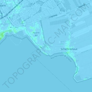
Name: Munnickaij topographic map, elevation, terrain.
Location: Munnickaij, Hoorn, Noord-Holland, Nederland, 1627 LA, Nederland (52.61564 5.08578 52.65564 5.12578)
Average elevation: 0 m
Minimum elevation: -6 m
Maximum elevation: 7 m
Make a donation
Gear up for your next adventure:
As an Amazon Associate, this site earns from qualifying purchases at no extra cost to you.