
Longirod topographic map
Interactive map
Click on the map to display elevation.
About this map
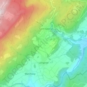
Name: Longirod topographic map, elevation, terrain.
Location: Longirod, District de Nyon, Waadland, 1261, Zwitserland (46.48046 6.21958 46.53022 6.28861)
Average elevation: 985 m
Minimum elevation: 726 m
Maximum elevation: 1,485 m