
Panda topographic map
Interactive map
Click on the map to display elevation.
About this map
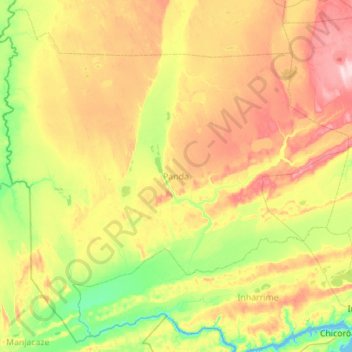
Name: Panda topographic map, elevation, terrain.
Location: Panda, Inhambane Province, Mozambique (-24.53783 33.89048 -23.57664 35.00207)
Average elevation: 80 m
Minimum elevation: -1 m
Maximum elevation: 229 m