
Make a donation
Gear up for your next adventure:
As an Amazon Associate, this site earns from qualifying purchases at no extra cost to you.
Ransdorp topographic map
Click on the map to display elevation.
Make a donation
Gear up for your next adventure:
As an Amazon Associate, this site earns from qualifying purchases at no extra cost to you.
About this map
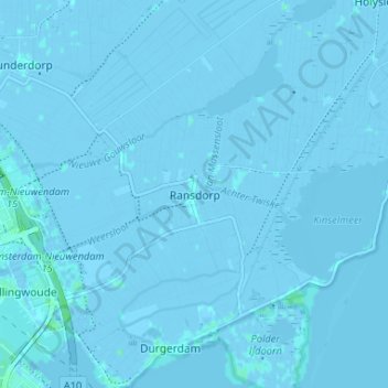
Name: Ransdorp topographic map, elevation, terrain.
Average elevation: -1 m
Minimum elevation: -6 m
Maximum elevation: 6 m
Make a donation
Gear up for your next adventure:
As an Amazon Associate, this site earns from qualifying purchases at no extra cost to you.
Other topographic maps
Click on a map to view its topography, its elevation and its terrain.
Rembrandtpark
Nederland > Noord-Holland > Amsterdam
Het park verdween jarenlang uit beeld, maar wat ooit als ideaal werd gezien, werd later als ongewenst beschouwd. Door de wilde begroeiingen werd het park onveilig gevonden. Het Stadsdeel West ging zich met het beheer bemoeien en er werd flink gesnoeid. In de grond wijzigde het gehele park naar aanleiding van…
Average elevation: 4 m