Geolocate

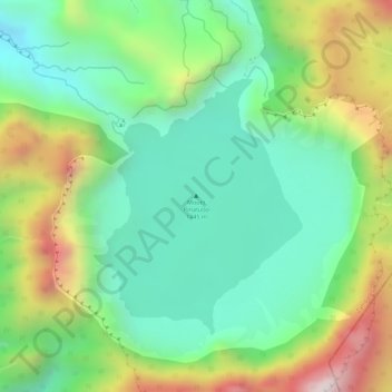
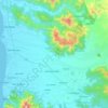
Mount Pinatubo topographic map

Click on the map to display elevation.

Mount Pinatubo

Even before the 1991 eruption, Mount Pinatubo had little topographic prominence: it was 1,745 m (5,725 ft) above sea level, only about 600 m (2,000 ft) above nearby plains, and only about 200 m (660 ft) higher than surrounding peaks, which largely obscured it from view. It is part of a chain of volcanoes which lie along the western side of the island of Luzon called the Zambales Mountains.

Wikipedia (CC-BY-SA 3.0)

About this map

Name: Mount Pinatubo topographic map, elevation, terrain.

Location: Mount Pinatubo, Zambales, Central Luzon, Philippines (15.14451 120.34901 15.14461 120.34911)

Average elevation: 1,047 m

Minimum elevation: 819 m

Maximum elevation: 1,424 m

Other topographic maps

Click on a map to view its topography, its elevation and its terrain.
Hermana Mayor Island

Philippines > Zambales

Average elevation: 4 m

Capones

Philippines > Zambales

Average elevation: 1 m

Hermana Menor Island

Philippines > Zambales

Average elevation: 1 m

Subic

Philippines > Zambales

Average elevation: 170 m

Anawangin Cove

Philippines > Zambales

Average elevation: 60 m

Nagsasa Cove

Philippines > Zambales

Average elevation: 38 m

Camara

Philippines > Zambales

Average elevation: 0 m

Redondo Peninsula

Philippines > Zambales

Average elevation: 120 m

Mapanuepe Lake

Philippines > Zambales > Aglao

Average elevation: 195 m

Mangan-vaca River

Philippines > Zambales > Subic > Ilwas

Average elevation: 33 m

Santo Tomas River

Philippines > Zambales > Rabanes

Average elevation: 130 m

Acid Lake

Philippines > Zambales > Subic

Average elevation: 390 m

Subic

Philippines > Zambales

Average elevation: 170 m

Subic

Philippines > Zambales

Average elevation: 170 m

Santo Tomas River

Philippines > Zambales > Rabanes

Average elevation: 130 m

Subic

Philippines > Zambales

Average elevation: 170 m

Nagsasa Cove

Philippines > Zambales

Average elevation: 38 m

Gear up for your next adventure:

👕UPF 50+ Sun Shirts - Essential protection against the harsh Australian sun during field work
🛰️Handheld GPS Units - Rugged GPS devices for tracking coordinates and elevation in the Australian bush
📱Tablet Tripod Mounts - Steady platforms for viewing digital maps or taking long exposures
🥾Trail Running Shoes - Shoes for trail running
🌿Flora and Fauna Field Guides - Identify the plants and animals you encounter on your route

As an Amazon Associate, this site earns from qualifying purchases at no extra cost to you.