
Agerola topographic map
Interactive map
Click on the map to display elevation.
About this map
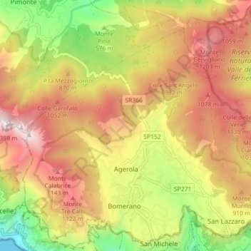
Name: Agerola topographic map, elevation, terrain.
Location: Agerola, Napoli, Campanie, 80051, Italie (40.62082 14.50943 40.67315 14.58049)
Average elevation: 743 m
Minimum elevation: 0 m
Maximum elevation: 1,400 m