Geolocate

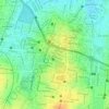
560003 topographic map

Click on the map to display elevation.

About this map

Name: 560003 topographic map, elevation, terrain.

Location: 560003, Malleswaram, Bengaluru, Bangalore North, Bengaluru Urban, Karnataka, India (13.00158 77.57338 13.00168 77.57348)

Average elevation: 924 m

Minimum elevation: 886 m

Maximum elevation: 954 m

Other topographic maps

Click on a map to view its topography, its elevation and its terrain.
Cubbon Park

India > Karnataka > Bangalore North > Bengaluru

Average elevation: 917 m

Byatarayanapura

India > Karnataka > Bangalore North > Bengaluru

Average elevation: 896 m

Herohalli Lake

India > Karnataka > Bangalore North > Bengaluru

Average elevation: 911 m

HRBR Layout

India > Karnataka > Bangalore North > Bengaluru

Average elevation: 895 m

Basava Dhama Park

India > Karnataka > Bangalore North > Bengaluru

Average elevation: 920 m

Gear up for your next adventure:

🚗Car Camping Gear - Equipment for vehicle camping
🎒Tactical Waist Packs - Quick access to your compass, phone, and snacks while walking
🎒Hiking Backpacks - Backpacks designed for hiking and trekking
🐍Snake Gaiters - Protection against snake bites
🛠️Outdoor Repair Kits - Gear repair kits

As an Amazon Associate, this site earns from qualifying purchases at no extra cost to you.