
Thank you for supporting this site ❤️
Make a donation
Make a donation
Gear up for your next adventure:
As an Amazon Associate, this site earns from qualifying purchases at no extra cost to you.
Ulassa/Ulassai topographic map
Click on the map to display elevation.
Thank you for supporting this site ❤️
Make a donation
Make a donation
Gear up for your next adventure:
As an Amazon Associate, this site earns from qualifying purchases at no extra cost to you.
About this map
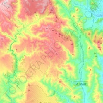
Name: Ulassa/Ulassai topographic map, elevation, terrain.
Location: Ulassa/Ulassai, Nuoro, Sardinia, 08040, Italy (39.60267 9.38549 39.82123 9.56183)
Average elevation: 448 m
Minimum elevation: 12 m
Maximum elevation: 1,086 m
Thank you for supporting this site ❤️
Make a donation
Make a donation
Gear up for your next adventure:
As an Amazon Associate, this site earns from qualifying purchases at no extra cost to you.