
Thank you for supporting this site ❤️
Make a donation
Make a donation
Gear up for your next adventure:
🛰️Handheld GPS Units - Rugged GPS devices for tracking coordinates and elevation in the Australian bush
As an Amazon Associate, this site earns from qualifying purchases at no extra cost to you.
Asten topographic map
Click on the map to display elevation.
Thank you for supporting this site ❤️
Make a donation
Make a donation
Gear up for your next adventure:
As an Amazon Associate, this site earns from qualifying purchases at no extra cost to you.
About this map
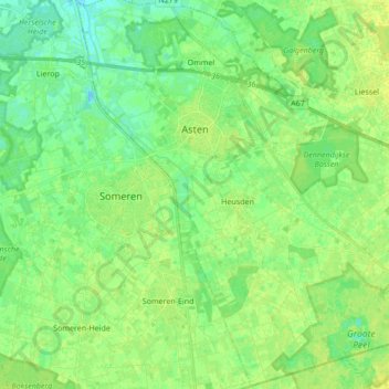
Name: Asten topographic map, elevation, terrain.
Location: Asten, Noord-Brabant, Nederland (51.35029 5.69998 51.42215 5.87036)
Average elevation: 27 m
Minimum elevation: 19 m
Maximum elevation: 34 m
Thank you for supporting this site ❤️
Make a donation
Make a donation
Gear up for your next adventure:
As an Amazon Associate, this site earns from qualifying purchases at no extra cost to you.
Other topographic maps
Click on a map to view its topography, its elevation and its terrain.