
Ferré topographic map
Interactive map
Click on the map to display elevation.
About this map
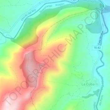
Name: Ferré topographic map, elevation, terrain.
Location: Ferré, La Cuba, Maestrazgo, Teruel, Aragon, Espagne (40.58876 -0.31874 40.60876 -0.29874)
Average elevation: 958 m
Minimum elevation: 799 m
Maximum elevation: 1,213 m