Geolocate

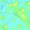
Velom topographic map

Click on the map to display elevation.

About this map

Name: Velom topographic map, elevation, terrain.

Location: Velom, Vadakara, Kozhikode, Kerala, 673508, India (11.59910 75.71952 11.63910 75.75952)

Average elevation: 18 m

Minimum elevation: -1 m

Maximum elevation: 144 m

Other topographic maps

Click on a map to view its topography, its elevation and its terrain.

Payamkuttimala

India > Kerala > Vadakara > Mandarathur

Average elevation: 26 m

Gear up for your next adventure:

🦟Heavy Duty Insect Repellent - Essential protection against flies, mozzies, and march flies
🚴Cycling Backpacks - Backpacks for cyclists
👟Lightweight Trail Runners - Agile footwear for fast movement over rugged Australian terrain
🔥Ferrocerium Rod Fire Starters - Reliable fire lighting in wet or windy conditions without matches
🗺️Topographic Maps - Detailed maps for hiking and navigation

As an Amazon Associate, this site earns from qualifying purchases at no extra cost to you.