
O Cádavo topographic map
Interactive map
Click on the map to display elevation.
About this map
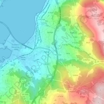
Name: O Cádavo topographic map, elevation, terrain.
Location: O Cádavo, Fene, Ferrol, La Coruña, Galicia, 15500, España (43.45362 -8.17960 43.49362 -8.13960)
Average elevation: 117 m
Minimum elevation: -3 m
Maximum elevation: 343 m