
Liers (Juprelle) topographic map
Interactive map
Click on the map to display elevation.
About this map
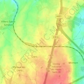
Name: Liers (Juprelle) topographic map, elevation, terrain.
Location: Liers (Juprelle), Juprelle, Liège, Wallonie, 4450, Belgique (50.68027 5.54942 50.72027 5.58942)
Average elevation: 159 m
Minimum elevation: 127 m
Maximum elevation: 187 m