Geolocate

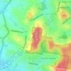
Aspley topographic map

Click on the map to display elevation.

About this map
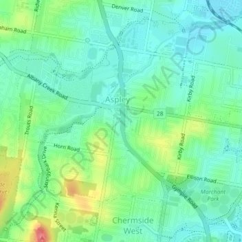
Name: Aspley topographic map, elevation, terrain.

Location: Aspley, City of Brisbane, Queensland, Australia (-27.37905 153.00107 -27.35233 153.03662)

Average elevation: 35 m

Minimum elevation: 12 m

Maximum elevation: 89 m

Queensland trails, hiking, mountain biking, running and outdoor activities

Other topographic maps

Click on a map to view its topography, its elevation and its terrain.

Bulimba Creek

Australia > Queensland > City of Brisbane

Average elevation: 11 m

Tangalooma

Australia > Queensland > City of Brisbane

Average elevation: 41 m

Enoggera Hill

Australia > Queensland > City of Brisbane

Average elevation: 114 m

Enoggera Dam

Australia > Queensland > City of Brisbane

Average elevation: 90 m

Tangalooma

Australia > Queensland > City of Brisbane

Average elevation: 41 m

Blunder Creek

Australia > Queensland > City of Brisbane

Average elevation: 26 m

Gear up for your next adventure:

🦘Outback Survival Gear - Essential gear for Australian outback
🧴Sunscreen SPF - Sun protection for outdoor activities
🧼Biodegradable Outdoor Soap - Clean gear and yourself without harming the local ecosystem
🔥Camping Stoves - Portable stoves for outdoor cooking
🧥Insulated Down Jackets - High warmth-to-weight ratio for cold nights in the high country

As an Amazon Associate, this site earns from qualifying purchases at no extra cost to you.